Engineering Technology - Geomatics

Engineering Technology - Geomatics - AAS
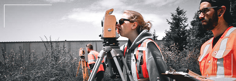
If you’d like to prepare for a career in a growing field that won’t confine you to an office, then check out the Geomatic Engineering Technology associate degree program at Bellingham Technical College. You can put your math and computer skills to work as a surveying and mapping technician or land surveyor in a construction firm; a surveying and engineering firm; a mining, oil or gas company; a public utility; or a government agency, such as U.S. Geological Survey, Department of Natural Resources, the Bureau of Land Management, or the U.S. Forestry Service.
BTC’s associate degree in Geomatics includes training in GIS, AutoCAD and GPS skills, as well as gain a working knowledge of Washington laws and standards related to surveying, boundaries and map preparation.
Employment Information
Data are provided on a program (not credential) level
81% BTC graduate placement rate1
$63,207 starting annual wage2
$73,960 average annual wage2
$88,272 potential annual wage2
Entry Information
When Can I Start?
Students may begin working toward this degree quarterly.
What are the Minimum Entry Requirements?
A completed college admissions application and placement in English and math. BTC uses a Guided Self-Placement process to help you choose the best starting point for your English and math courses. Your selections will determine whether you begin with program coursework or complete prerequisites classes first.
To get started or for help determining your English and math placement, contact the Outreach department at Outreach@btc.edu.
What are My Next Steps?
Classes
Total Program Credits: 98
Academic Core
AMATH 111 Applied Technical Math 5 CR (Can substitute MATH& 141 for AMATH 111) ENGL& 101 English Composition I 5 CR CMST& 220 Public Speaking 5 CR (Can substitute CMST& 210 for CMST& 220)
TOTAL Academic Core Course Credits15 CR Engineering Core
ENGR 115 Graphics 5 CR ENGT 134 AutoCAD I 5 CR ENGT 135 AutoCAD II 5 CR
TOTAL Engineering Core Course Credits15 CR Technology Course Work
CET 102 Fundamentals Of Surveying I 5 CR CET 103 Fundamentals Of Surveying II 5 CR CET 110 Construction And Highway Surveys 5 CR ENGT 132 Engineering Applications Using MS Office 5 CR CET 141 Fundamentals Of GIS & GPS 5 CR CET 142 Intermediate GIS 5 CR CET 205 Survey of Public Lands 5 CR CET 210 Boundary Law & Land Description 5 CR CET 215 Environmental Mapping 5 CR CET 220 GPS Systems 5 CR CET 225 Advanced Survey Seminar 5 CR CET 251 AutoCAD Civil 3D I 5 CR
TOTAL Geomatics Core Course Credits60 CR Engineering Electives
BIOL& 160 General Biology w/ Lab 5 CR BUS 123 Records Management 3 CR CAP 101 Microsoft Computer Applications 5 CR ECON& 201 Micro Economics 5 CR
TOTAL Engineering Elective Credits8 CR Any CENG, CET, ENET or ENGT course 100 level or higher* Any Chemistry course 100 level or higher Any Math course 141 or higher* Any Physics course 100 level or higher *Courses taken to meet General Education, Program Core, or Program Specialty requirements may not be used to meet the Elective requirements.
Program Outcomes
- Graduates will demonstrate competency in basic GIS and surveying and mapping skills;
- Graduates will prepare for the Level I Survey Technical Exam given by the Career Development Committee of LSAW;
- Graduates will possess the ability to prepare a topographic map of a parcel of property that is evaluated by WAC 332-130 standards;
- Graduates will demonstrate entry level competency in using CAD skills;
- Graduates will demonstrate a working knowledge of the Global Positioning System (GPS) as well as demonstrate a working knowledge of Washington Law related to surveying and boundaries;
- Graduates will receive, interpret, and convey written, verbal, and graphic information.
Employment Outlook
Employment of surveying and mapping technicians is expected to increase faster than average nationally. Job openings will continue to result from the need to replace workers who transfer to other occupations or leave the labor force altogether.
Criminal convictions may restrict or prevent student participation with internships and employment in this industry.
Most program graduates work as surveying and mapping technicians and are employed in direct field service. Opportunities exist in construction companies, private surveying and engineering firms, mining, oil, and gas extraction companies, public utilities, and city, county, state, and federal government agencies (i.e., U.S. Forestry Department, Department of Natural Resources, Department of Interior, U.S. Geological Survey, and Bureau of Land Management).
Faculty & Support

Colin Hopps
GeomaticsContacts
If you have questions about this program or want help with the admissions steps to Bellingham Technical College, please email outreach@btc.edu.
Current students wanting academic planning and support, can connect with the program Instructor(s) or email EngineeringNav@btc.edu
